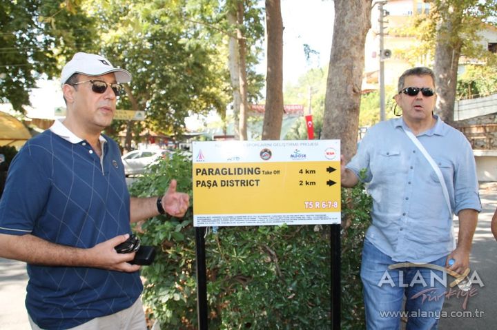
The on-site promotion of the Alanya Nature Sports Development Project, which was brought to Alanya through an application made by the Alanya Tourist Operators Association (ALTİD) to the Western Mediterranean Development Agency (BAKA), has been completed. One of the routes of the project, which consists of a total of 31 tracks, was toured with safari jeeps for members of the press and tourism agency officials.
“THE LONGEST DISTANCE IS 30 KILOMETERS”
Stating that they have carried out the promotion of the “Alanya Nature Sports Development Project,” which was established with the support of BAKA in terms of developing alternative tourism, ALTİD President and Türkiye Hotel Association (TÜROFED) Board Member Burhan Sili said, “We have determined a total of 31 tracks consisting of what are referred to as hiking, cycling, and off-road routes that can be done with jeeps. By creating demand on these tracks, where the shortest distance is 4.5 and the longest distance reaches 30 kilometers, we want to announce the historical and natural beauties of our Alanya to the world, beyond the triad of sea, sand, and sun. Thus, by ensuring that the rural sector can also take a share of the tourism pie, we aim to conduct tourism in a holistic manner.”
“WE WILL BRING PEOPLE TOGETHER IN ALANYA WITH NATURE SPORTS”
“By contributing to the formation of alternative tourism areas, we plan to introduce our domestic and foreign guests—who have visited our region many times, stayed for long periods, live permanently, or have not yet discovered Alanya—to nature sports in our region,” they said.
"WALKING THE TRAILS TAKES AT LEAST 30 DAYS"
Stating that they have printed 20,000 trekking, cycling, and off-road route maps with the project, Sili stated that at least 30 of the total 31 routes in these maps, printed as part of the nature sports project, can be hiked in a duration of at least 30 days.
“A VERY IMPORTANT PROJECT FOR WINTER TOURISM”
Suat Çavuşoğlu, President of the Association of Turkish Travel Agencies (TÜRSAB) Alanya Regional Executive Board (BYK), emphasized that the project—prepared under the leadership of ALTİD and with the contributions of BAKA, Alanya Nature Sports Club (ALDOSK), Alanya Municipality, and Alanya Promotion Foundation (ALTAV)—holds great importance for tourists, particularly during the spring and winter months, and that a major step has been taken to revitalize winter tourism.
“IMPORTANT STEPS TAKEN FOR ORIENTEERING”
Project official and Archaeologist İlhami Yetkin stated that the project was prepared through years of accumulation and long-term field studies despite being very exhausting, and added that important steps for orienteering—a sport that pits humans against time to find goals and directions—were also taken with this project.
PROJECT SUMMARY:
The participants of the project launched under the sponsorship of BAKA by ALTİD are Alanya Municipality, ALDOSK, and ALTAV. Within the scope of the project, with a map drawn by determining walking, cycling, and off-road tracks, trekking, cycling, and off-road routes have been established on existing interconnected roads in an area totaling 2,240 km2, with a width of 56 km and a depth of 40 km, encompassing the ancient cities of Syedra and Laertes in the east, Akdağ Ski Center in the northeast, Oba – Alacami, Kızılalan, Aksaray, Basırlı, Mahmutseydi, Türktaş, Süleymanlar, Gümüşgöze, Burçaklar, Karamanlar, Gedevet, Alara Han in the west, Hamaxia, the Küçük Ayasofya historical area in the north, and the Alanya center and Karayolları Locality in the south. Starting from the Alanya center, route map information boards, kilometer-marked project directional signs, marker poles at high and steep points, two (2) passage bridges in the Kızılalan Locality where mountain bike organizations are also held, one Cebelireis paragliding take-off point, and two towers built for Alanya panoramic view/observation/meeting purposes at the Yasır Ali Locality above the Hıdırelles Church, have been installed. A total of 31 routes have been determined, including 19 walking/trekking, cycling, and off-road/vehicle track routes, 12 of which are walking/trekking-only track routes.
20 THOUSAND TREKKING MAPS PRINTED
A total of 20,000 trekking and cycling route maps and 20,000 route introductory booklets have been printed in Turkish, English, German, and Russian. The printed maps and booklets will contribute to the product diversification of our destination through their distribution at tourism fairs and via other contacts. Additionally, brochures and maps will be distributed in Alanya hotels and through agencies and tour operators. With the kilometer-based directional signs completed as part of the project, it is ensured that a person can easily explore the region without getting lost. An orienteering map has also been prepared for a location that has seen increasing interest in recent years.